Geographic Information Systems (GIS)
Geographic Information Systems (GIS)
Gibson-Thomas offers geospatial services that can assist utilities and organizations in developing Geographic Information Systems (GIS) for infrastructure assets including water, waste water, stormwater and transportation systems. With the use of ESRI ArcGIS and ArcInfo software, our experienced professional team can provide geospatial services that include mapping, database development, asset management, and analysis of your infrastructure system. Through our team’s expertise using Trimble software and equipment, we can provide you with all of your GPS mapping needs.
Gibson-Thomas provides comprehensive modeling services for drinking water utilities, enabling analysis and management of distribution networks. With use of InfoWorks Water Supply (WS), our experienced professional team can provide an accurate view of the network performance of drinking water infrastructure systems and assist in meeting operational targets. Our team can investigate supply deficiencies, demand management, optimization of pumping and storage systems, assessment of supply at an individual customer level, water quality and chlorination assessment, scenario planning and fire flow analysis, planning of capital investment programs and simulation of pollution incidents.
Recent Geographic Information Systems (GIS) Projects
-
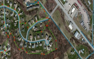
 Municipal Authority of Buffalo Township GIS System
Butler County, PA
-
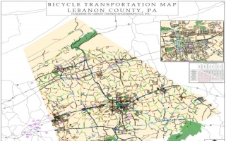
 Lebanon County Bicycle Map
Lebanon County, PA
View All Projects

